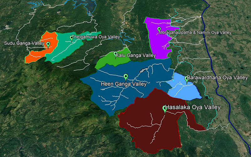
 Once the Green researchers saw that it must approach the intervention via river basins, they identified seven rivers for treatment. These area the Sudu Ganga, the Kalu Ganga, the Thelgamu Oya, the Heen Gaanga, the Hasalaka Oya, the Barawardhana Oya and the Namini Oya. Akila and Tharindu mapped all of the areas for each of the river basins and through both visual and analytical exercises and determined the exact catchments and microcatchments, the possibilities for pollution and of course, the points where chemical and soil testing would need to be done in order to arrive at baselines for those. While they were engaged in these activities, Jayantha, our environmentalist was looking for any climate or damage related data in those areas while Nimal, our agronomist determined the lay of the land with respect to agriculture. Arjuna meanwhile brought his abilities to read communities and make sense of the various sectoral upstreams into a coherent, logical map of the dynamics of the terrain. While the terrain mapping went well, the team ran into problems acquiring climate and damage related data in the target areas. That was troublesome and did not bode well for the quality of the inception report.
18
Feb
0 Comment


